 seedlookout
JAVA 26.3 · VERIFIED IN GAME
Taiga coast village and outpost beside a snowy hillside
Spruce-roofed village houses follow a blue shoreline beneath a wooded hill, with a pillager tower along the coast and an igloo by frozen water.
 Village
 Pillager outpost
 Shipwreck
 Igloo
Igloo Taiga
Taiga Coast
Coast Snow
Snow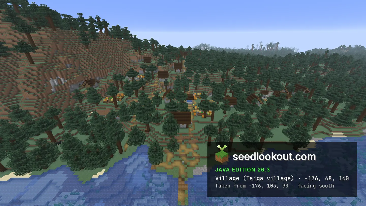
About this world
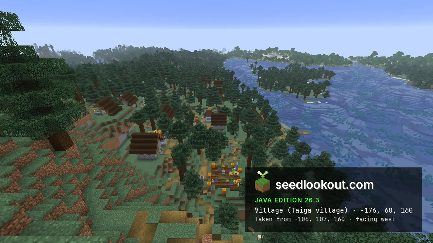
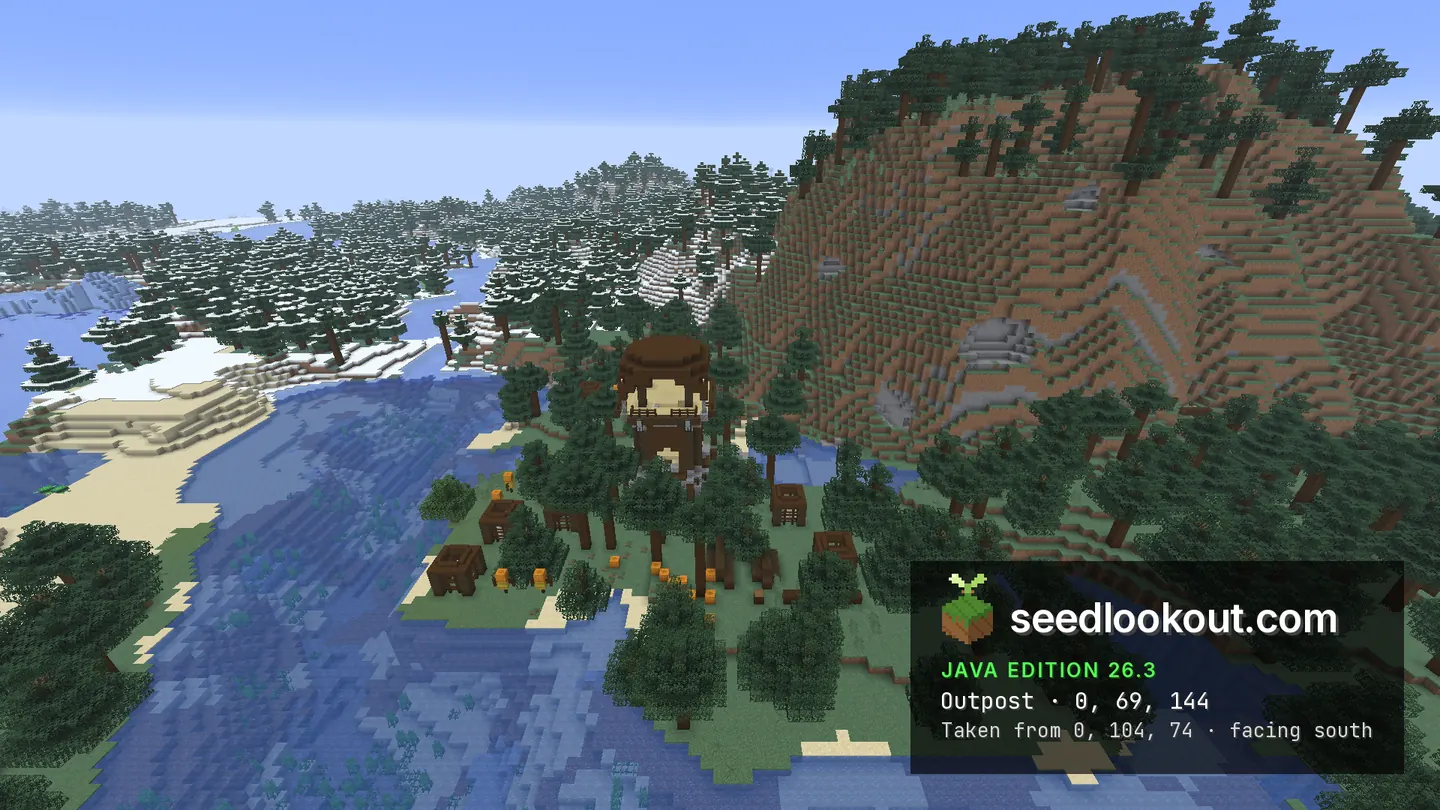
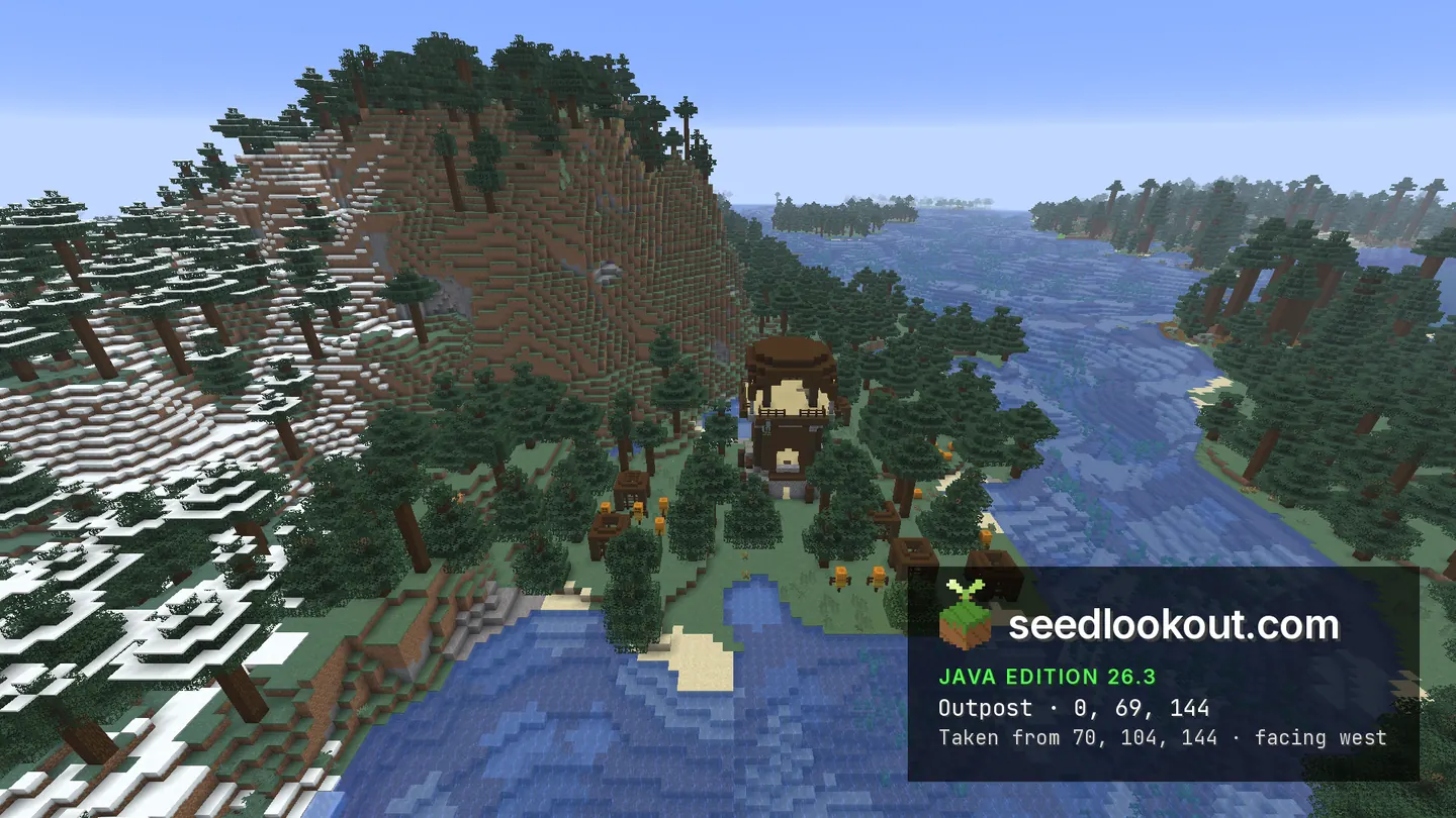
The taiga village at -176, 68, 160 occupies a wooded coast in Java 26.3. Dark roofs and yellow paths run between spruce trees at the foot of a steep hill, with water along the outer edge of the settlement. A pillager outpost at 0, 69, 144 stands on another clearing along the shore, where green forest meets the snowy slope.
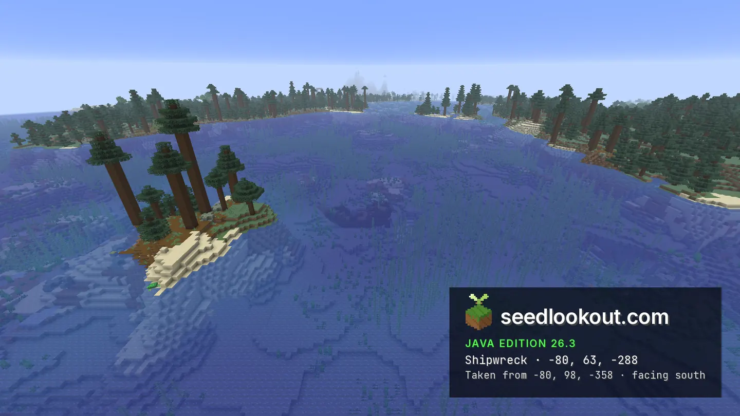
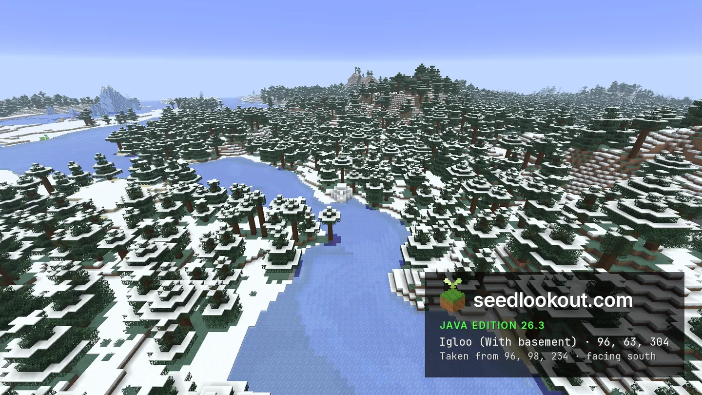
North of the village, a wooden shipwreck lies underwater near -80, -288. Its hull is visible below the surface beside a small spruce island, and the generated wreck spans y 49–57. To the south-east, the igloo at 96, 63, 304 sits beside a frozen river through snow-covered forest. The gallery shows the dome; the below-ground portion of the igloo was not photographed.
Coordinates
Each structure was found at or near these coordinates in Java 26.3.
| Location | X | Y | Z | Teleport |
|---|---|---|---|---|
| Taiga villageSpruce-roofed houses and village paths along the coast beneath a steep wooded hill.Taiga village found at these coordinates | -176 | 68 | 160 | |
| Pillager outpostA dark wooden tower on the wooded shoreline, with a snowy hillside nearby.Pillager outpost found at these coordinates | 0 | 69 | 144 | |
| Submerged shipwreckThis is a surface anchor. The wreck lies around x -88 to -61, z -277 to -269 and y 49–57; its hull is visible under water.Shipwreck found 11 blocks away | -80 | 63 | -288 | |
| IglooSnow dome beside a frozen river. Generated igloo pieces extend down to y 47, but the below-ground rooms are not shown.Igloo found at these coordinates | 96 | 63 | 304 |
Screenshots
Select a screenshot to open it at full size.
How to get there
- In Java Edition 26.3, choose Create New World, open the World tab and enter seed 272987006062197.
- Set Game Mode to Creative or turn Allow Cheats on, and press F3 to show your coordinates.
- Run /tp @s -176 125 160 to view the village roofs and coastal paths from above. The village point is at y 68.
- For the coastal tower, run /tp @s 0 125 144. The outpost clearing is at 0, 69, 144.
- For the wreck, run /tp @s -80 100 -288 and look underwater slightly south of the anchor, around z -277 to -269. Its generated hull is between y 49 and 57.
- Run /tp @s 96 105 304 for the igloo beside the frozen river. The white dome is at about y 63.
Questions
Where is the taiga village?
Its checked point is -176, 68, 160 in Java 26.3. Houses and paths follow the wooded shoreline below a steep spruce-covered hill.
Can I see the outpost and shipwreck?
Yes. The gallery shows the outpost at 0, 69, 144 and a submerged hull near -80, -288. Water reduces the wreck’s contrast, so the north view is the clearest.
Does the igloo have photographed basement rooms?
No. Generated igloo pieces extend below the dome to y 47, but the screenshots show only the surface igloo beside the frozen river. Its interior contents were not checked.
Which Minecraft version was checked?
The world and screenshots were checked in Java 26.3. We have not verified the same terrain and structures in Bedrock or other Java versions.
Verified in game
Verified in game in Minecraft Java 26.3 on 2026-10-02. We checked the listed locations and reviewed the in-game screenshots before publication. Verification covers the listed structures in that version only, not the world spawn, chest loot or other versions. About verified seeds
Spawn and nearest structures
Predicted with the seed map’s Java 26.3 model and not checked in game. Distances are measured from the estimated spawn.
- Estimated spawn
- X 0, Z 0
- Surface height
- About Y 66
- Spawn biome
- Old Growth Pine Taiga
Nearest structures
| Structure | X | Z | From spawn |
|---|---|---|---|
| Pillager outpost | 0 | 144 | 144 blocks |
| VillageTaiga village | -176 | 160 | 238 blocks |
| Ocean ruin | 176 | 176 | 249 blocks |
| Shipwreck | -80 | -288 | 299 blocks |
| IglooBasement | 96 | 304 | 319 blocks |
| Buried treasure | 153 | 297 | 334 blocks |
| Ruined portal | 32 | 336 | 338 blocks |
| Trial chambers | 176 | 288 | 338 blocks |
| Trail ruins | -304 | 192 | 360 blocks |
| Abandoned camp | -576 | 80 | 582 blocks |
| Ocean monument | 1200 | 800 | 1,442 blocks |
| Jungle temple | -848 | -1472 | 1,699 blocks |
| Ancient city | -688 | -1904 | 2,024 blocks |
| Woodland mansion | -416 | 2144 | 2,184 blocks |
| Desert pyramid | -2976 | -832 | 3,090 blocks |
No witch hut within 4,096 blocks of spawn.
Nearest strongholds
| Stronghold | X | Z | From spawn |
|---|---|---|---|
| Ring 1 | 452 | -2252 | 2,297 blocks |
| Ring 1 | 1956 | 1524 | 2,480 blocks |
| Ring 1 | -2428 | 948 | 2,607 blocks |
Surface biomes within 1,024 blocks
- Cold Ocean 17%
- Snowy Plains 12%
- Plains 12%
- Taiga 11%
- Snowy Taiga 10%
- Ocean 7%
Biome map
The seed map shows this world’s biomes and predicted structures with its Java 26.3 model. Its markers are predictions, like the spawn facts. Only the Coordinates table was checked in game.
Open the Java 26.3 seed mapMore seeds
Pillager outpost and igloo on a snowy hill, with a wreck in an iceberg bay
Pillager outpostIglooShipwreckVillageSnow Ocean
Ocean3356402630148966
Taiga village on an icy coast with a forest outpost
VillagePillager outpost Trail ruins
 Abandoned campTaigaCoastSnow
167264166161780
Village above a stone hollow with an outpost in a cleft
VillagePillager outpostIglooAbandoned camp Plains
 Dappled forestCoast
168486502954112