 seedlookout
JAVA 26.3 · VERIFIED IN GAME
Taiga village between snowy forest and swamp water
A taiga village borders snowy spruce forest and green swamp waterways, with a ruined portal standing in shallow water farther east.
 Village
 Swamp hut
 Ruined portal
 Abandoned camp
 Taiga
Taiga Snow
Snow Swamp
Swamp River
River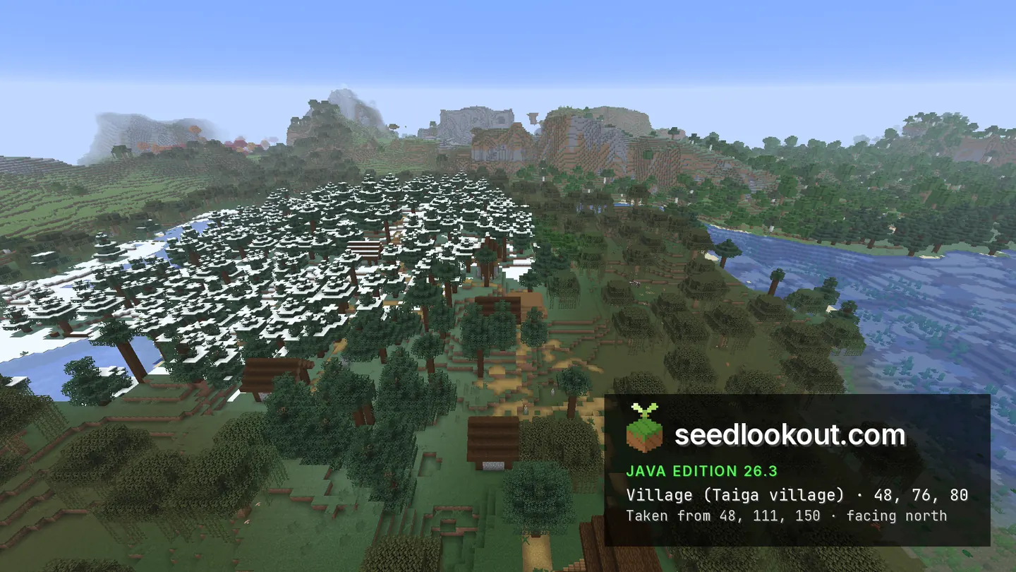
About this world
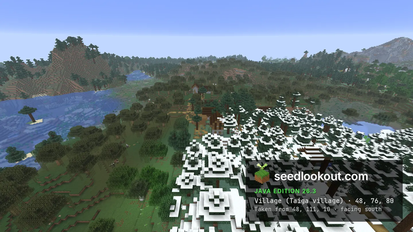
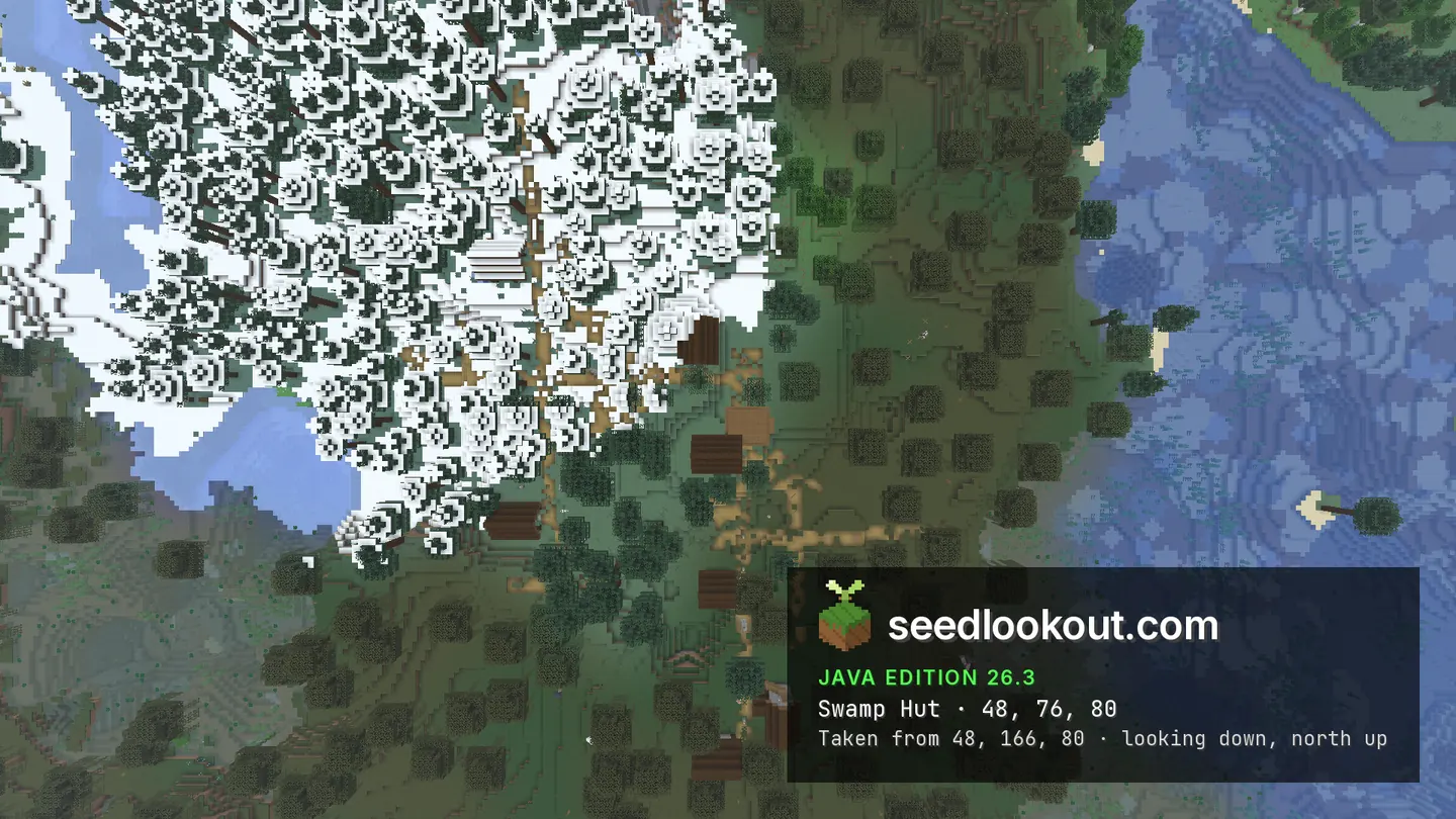
The taiga village at 48, 76, 80 sits where snowy spruce forest meets swamp trees and winding water. Dark wooden roofs and paths appear between the canopies, while the two sides of the settlement have visibly different ground cover. A swamp hut was confirmed at the same listed X and Z, but its roof blends into the trees and village in the overhead image.
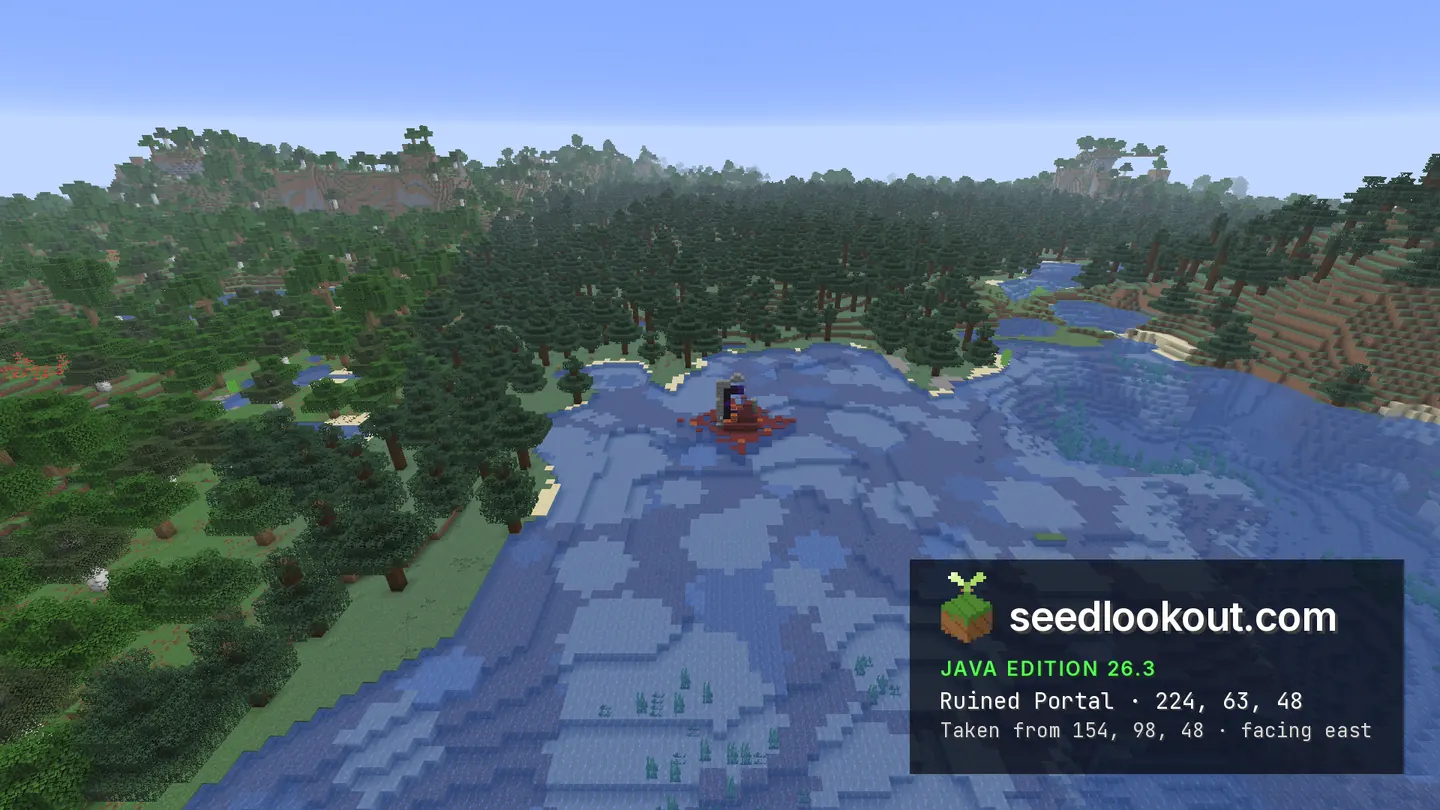
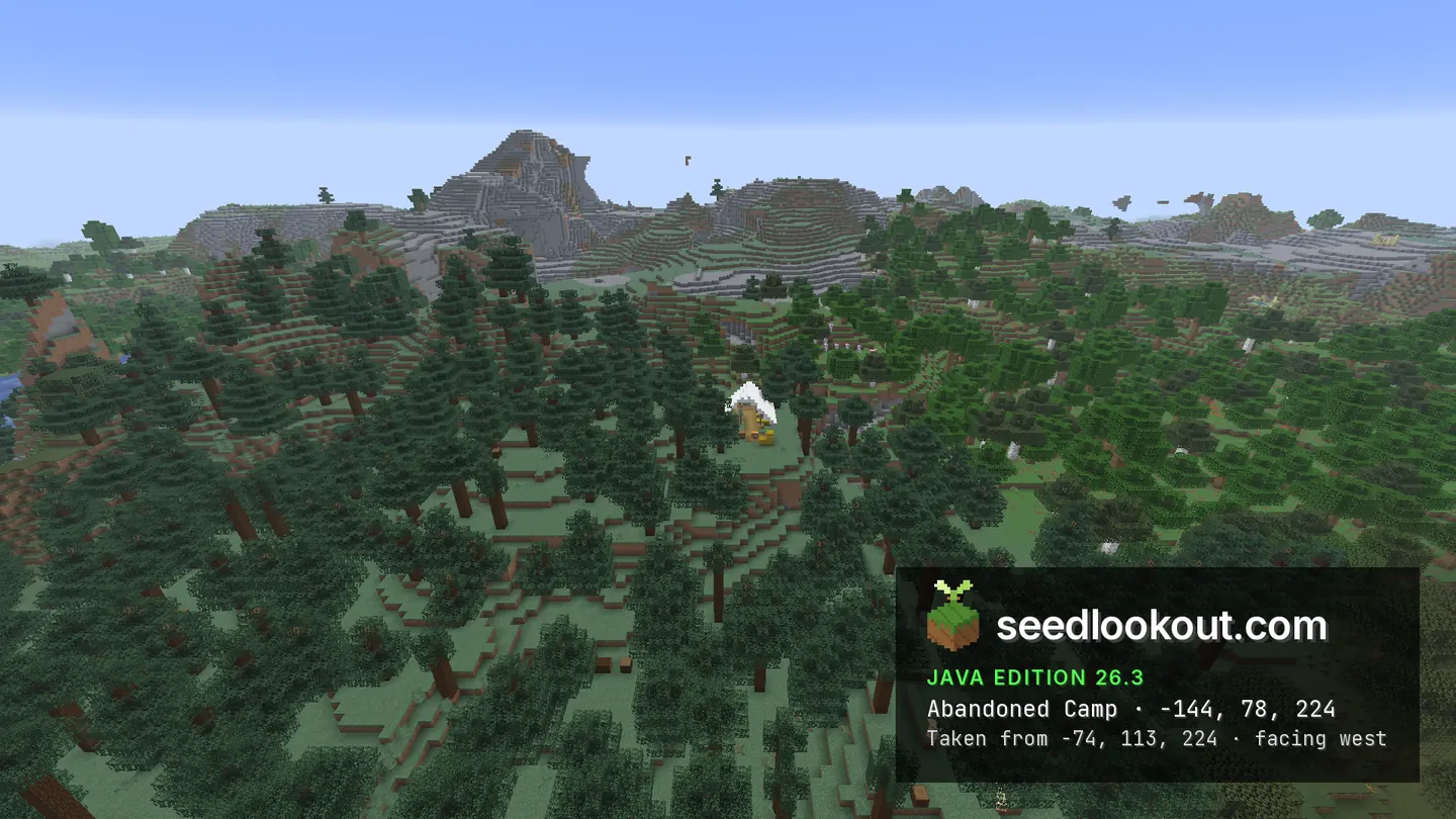
East of the village, the ruined portal at 224, 63, 48 is clearly visible in shallow water, with dark frame blocks and red surroundings. A separate abandoned camp lies southwest at -144, 78, 224. Its white tent can be seen among spruce trees; the generated camp sits between y 76 and 83.
Coordinates
Each structure was found at or near these coordinates in Java 26.3.
| Location | X | Y | Z | Teleport |
|---|---|---|---|---|
| Village at the snow and swamp edgeTaiga roofs and paths between snowy spruce forest and green swamp waterways.Taiga village found at these coordinates | 48 | 76 | 80 | |
| Swamp hutConfirmed at the same listed X and Z as the village, with blocks at y 71–77. Its roof is difficult to isolate in the overhead image.Swamp hut found at these coordinates | 48 | 76 | 80 | |
| Waterside ruined portalA visible dark portal frame and red block patch in the water east of the village, spanning y 62–71.Ruined portal found at these coordinates | 224 | 63 | 48 | |
| Spruce forest abandoned campA white tent among spruce trees southwest of the village, visible from the eastern camera view.Abandoned camp found at these coordinates | -144 | 78 | 224 |
Screenshots
Select a screenshot to open it at full size.
How to get there
- In Java Edition 26.3, choose Create New World, open the World tab and enter seed 525879814561908518.
- Set Game Mode to Creative or turn Allow Cheats on, and press F3 to show your coordinates.
- Run /tp @s 48 111 150 -180 26.6 to see the village at the snow and swamp edge from the gallery viewpoint.
- The hut shares the village anchor at 48, 76, 80. Inspect the area below the trees rather than treating the two records as one building.
- For the visible portal, run /tp @s 224 98 48 and look into the shallow water.
- For the forest camp, run /tp @s -144 113 224 and look down between the spruce trees.
Questions
Where is the village beside snow and swamp?
The checked village point is 48, 76, 80. Snowy spruce forest borders one side, while swamp trees and waterways occupy the other.
Do the village and hut use the same coordinates?
Yes. Both were checked at x 48, z 80. They are separate confirmed structure results; the gallery does not clearly isolate the hut roof from nearby buildings and trees.
Is the ruined portal visible in the water?
Yes. The portal near 224, 63, 48 appears above and within shallow water in the western view, with its dark frame and red surroundings visible.
Does this seed work on Bedrock or other Java versions?
We verified this world only in Java 26.3. Bedrock and other Java versions may generate different terrain and structures from the same seed.
Verified in game
Verified in game in Minecraft Java 26.3 on 2026-10-02. We checked the listed locations and reviewed the in-game screenshots before publication. Verification covers the listed structures in that version only, not the world spawn, chest loot or other versions. About verified seeds
Spawn and nearest structures
Predicted with the seed map’s Java 26.3 model and not checked in game. Distances are measured from the estimated spawn.
- Estimated spawn
- X 0, Z 0
- Surface height
- About Y 67
- Spawn biome
- Snowy Taiga
Nearest structures
| Structure | X | Z | From spawn |
|---|---|---|---|
| VillageTaiga village | 48 | 80 | 93 blocks |
| Witch hut | 48 | 80 | 93 blocks |
| Ruined portal | 224 | 48 | 229 blocks |
| Abandoned camp | -144 | 224 | 266 blocks |
| Trial chambers | 160 | 240 | 288 blocks |
| Trail ruins | 208 | 272 | 342 blocks |
| Pillager outpost | -688 | -480 | 839 blocks |
| Shipwreck | 560 | 976 | 1,125 blocks |
| Ancient city | -144 | 1184 | 1,193 blocks |
| Igloo | -944 | -912 | 1,313 blocks |
| Ocean ruin | 768 | 1088 | 1,332 blocks |
| Ocean monument | -1328 | 736 | 1,518 blocks |
| Jungle temple | -224 | -2960 | 2,968 blocks |
No desert pyramid or woodland mansion within 4,096 blocks of spawn. No buried treasure within 1,024 blocks of spawn.
Nearest strongholds
| Stronghold | X | Z | From spawn |
|---|---|---|---|
| Ring 1 | -972 | 1300 | 1,623 blocks |
| Ring 1 | 1764 | 180 | 1,773 blocks |
| Ring 1 | -892 | -2044 | 2,230 blocks |
Surface biomes within 1,024 blocks
- Plains 30%
- Forest 27%
- River 10%
- Taiga 8%
- Swamp 5%
- Birch Forest 5%
Biome map
The seed map shows this world’s biomes and predicted structures with its Java 26.3 model. Its markers are predictions, like the spawn facts. Only the Coordinates table was checked in game.
Open the Java 26.3 seed mapMore seeds
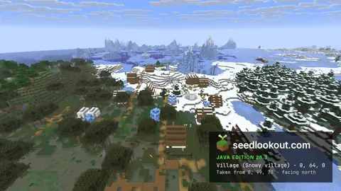
Snowy village on a swamp border, with a swamp hut and a wreck in the ice
VillageSwamp hut ShipwreckAbandoned campSnowSwamp
146114360905246199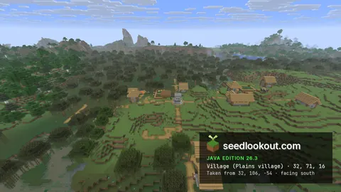
Swamp hut in the middle of a plains village
Swamp hutVillageAbandoned campRuined portalSwamp1748729253401579425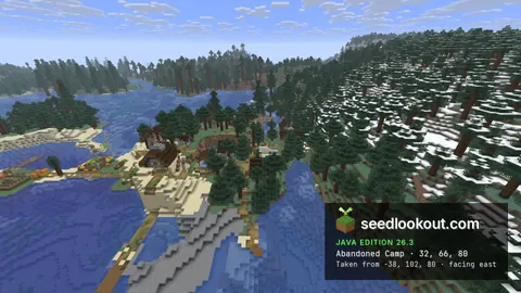
Taiga village on a lake point, with a camp among its houses
Abandoned campVillageRuined portal Trial chambersTaigaSnow
13213665042628