 seedlookout
JAVA 26.3 · VERIFIED IN GAME
White tent in tall spruce forest with a shoreline wreck
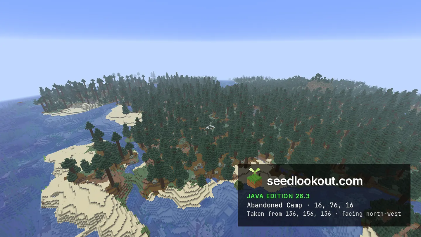
A white camp tent sits under tall spruce trees beside sandy ocean inlets, with part of a wooden wreck showing at the nearby shore.
 Abandoned camp
 Shipwreck
 Ruined portal
 Trail ruins
 Taiga
Taiga Coast
Coast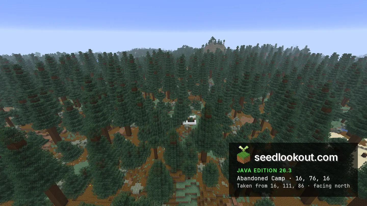
About this world
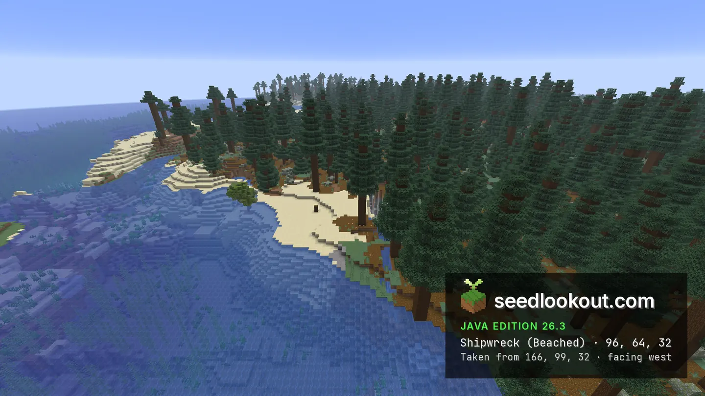
The abandoned camp near 16, 76, 16 is tucked into tall spruce forest beside sandy ocean inlets. Its white tent is visible beneath the trees in the photograph taken from the south, while the wider image shows the coastline weaving around the wooded ground. East of the camp, a partly buried shipwreck near 96, 64, 32 exposes wooden hull blocks at the shore.
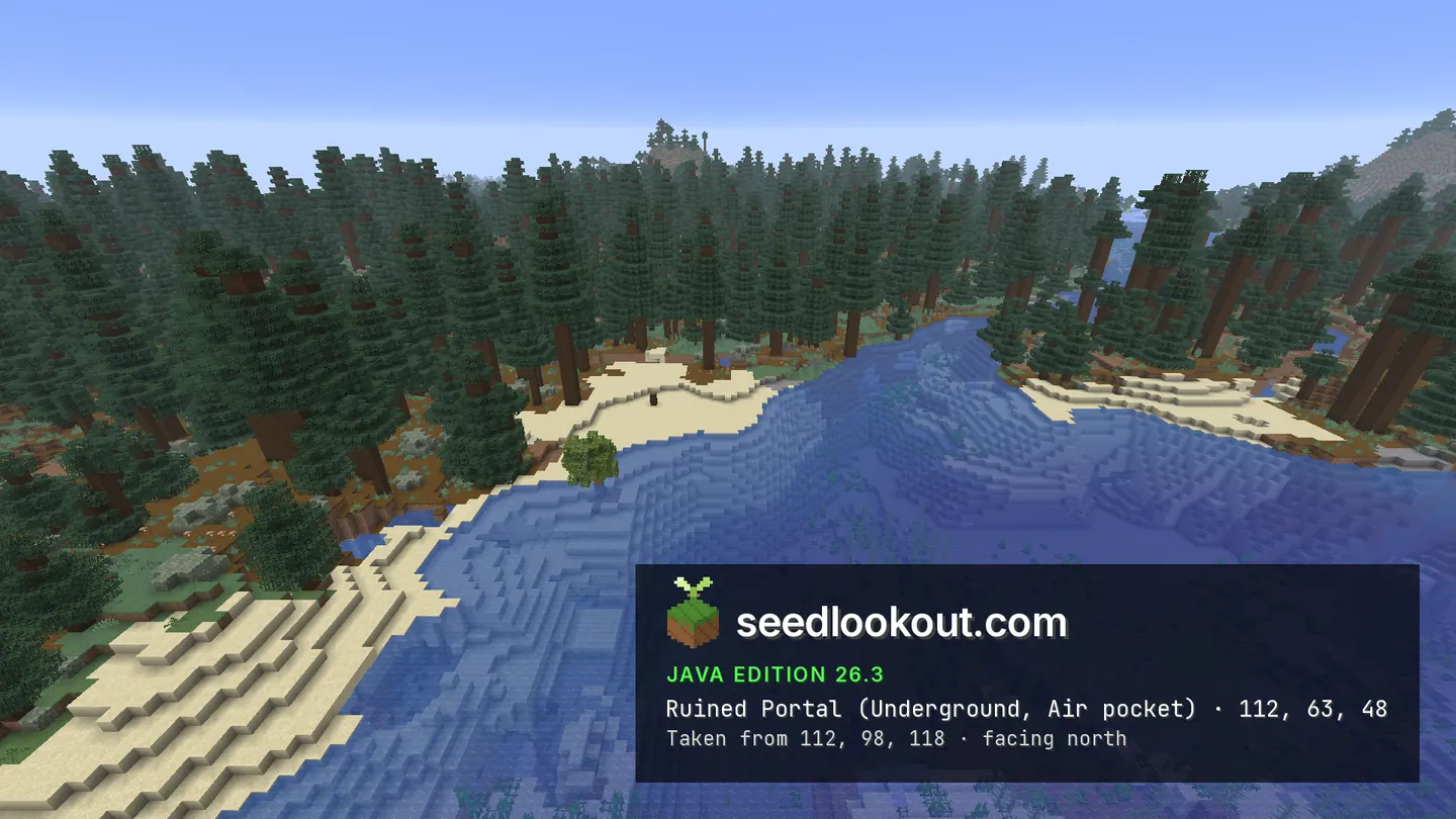
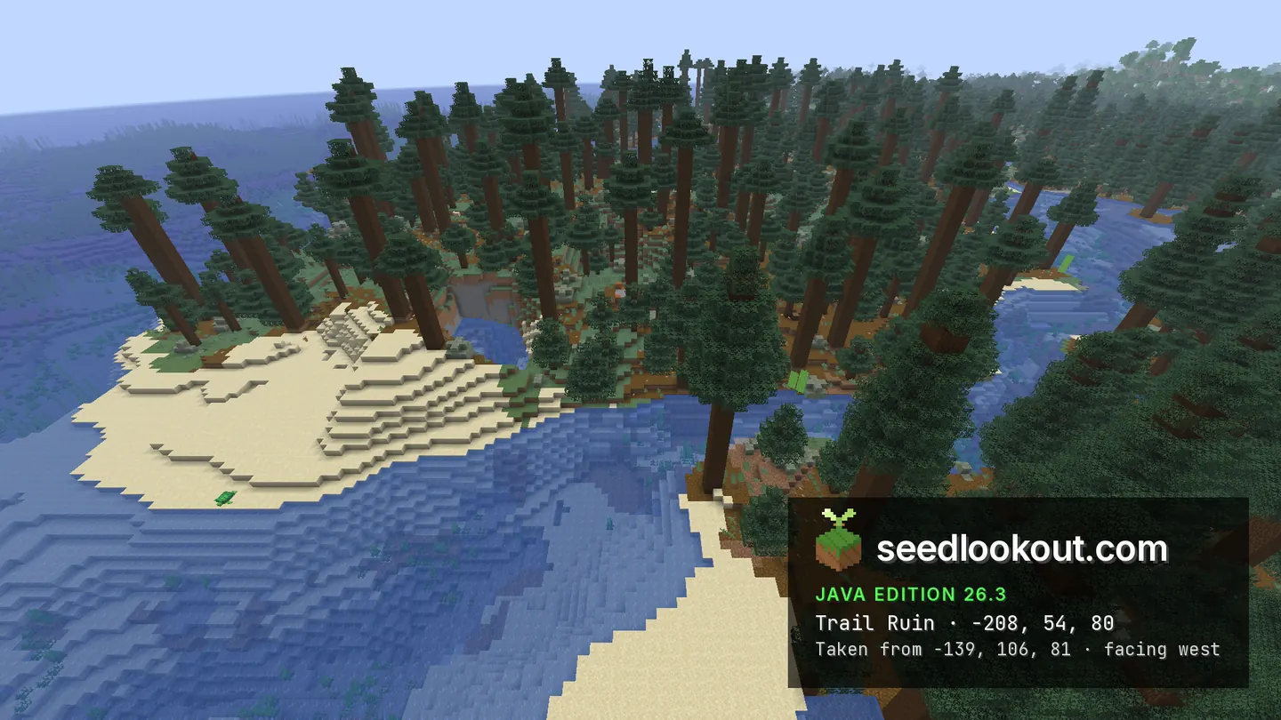
A ruined portal was confirmed beneath the surface anchor at 112, 63, 48, with its blocks at y 38–45. Its selected image shows the coast above the hidden ruin. Trail ruins beneath the forest near -208, 80 span y 39–69, with an inspection point at -209, 54, 81. The trail-ruin photograph remains above the forest canopy and does not show the buried structure.
Coordinates
Each structure was found at or near these coordinates in Java 26.3.
| Location | X | Y | Z | Teleport |
|---|---|---|---|---|
| Tall-spruce abandoned campA white tent visible beneath tall spruce trees beside coastal inlets. The listed y 76 is a surface anchor; camp blocks span y 66–73.Abandoned camp found at these coordinates | 16 | 76 | 16 | |
| Partly buried shoreline shipwreckWooden hull blocks are visible at the shore in the east view. The generated wreck spans y 52–72 around z 32–59.Beached shipwreck found at these coordinates | 96 | 64 | 32 | |
| Buried ruined portalThis y 63 point anchors the coastal surface above a portal at y 38–45. The selected photo shows the shore, not the hidden portal.Ruined portal found 1 block away | 112 | 63 | 48 | |
| Buried trail ruinsThe listed y 54 is an underground inspection height; the resolved point is -209, 54, 81. Bounds span y 39–69, and the gallery shows only forest above them.Trail ruins found at these coordinates | -208 | 54 | 80 |
Screenshots
Select a screenshot to open it at full size.
How to get there
- In Java Edition 26.3, choose Create New World, open the World tab and enter seed 86660878744450.
- Set Game Mode to Creative or turn Allow Cheats on, and press F3 to show your coordinates.
- Run /tp @s 16 111 16 to look down into the tall spruce forest. The white tent is beneath the canopy; camp blocks lie at y 66–73 below the listed surface point.
- For the shoreline wreck, use /tp @s 96 99 32 and look at the wooden blocks along z 32–59. The buried portal lies below 112, 63, 48 at y 38–45.
- To inspect the trail ruins, run /gamemode spectator, then /tp @s -209 54 81. This point lies underground within the checked structure, not at a verified surface entrance.
Questions
Is the white tent visible under the spruce trees?
Yes. The camp image taken from the south shows a white tent beneath the tall spruce canopy. The wider view adds the sandy inlets around the forest.
Is the shipwreck fully exposed?
No. Part of the wooden hull shows at the shore near 96, 64, 32, while other sections lie lower within a structure spanning y 52–72.
Can I see the portal or trail ruins in the gallery?
Their selected photographs show the surface above them. The portal is buried at y 38–45, and the trail ruins span y 39–69 beneath the forest.
Which Minecraft edition and version were checked?
This seed was checked in Java Edition 26.3. Other Java releases and Bedrock have not been checked.
Verified in game
Verified in game in Minecraft Java 26.3 on 2026-10-02. We checked the listed locations and reviewed the in-game screenshots before publication. Verification covers the listed structures in that version only, not the world spawn, chest loot or other versions. About verified seeds
Spawn and nearest structures
Predicted with the seed map’s Java 26.3 model and not checked in game. Distances are measured from the estimated spawn.
- Estimated spawn
- X 0, Z 0
- Surface height
- About Y 69
- Spawn biome
- Old Growth Spruce Taiga
Nearest structures
| Structure | X | Z | From spawn |
|---|---|---|---|
| Abandoned camp | 16 | 16 | 23 blocks |
| Shipwreck | 96 | 32 | 101 blocks |
| Ruined portal | 112 | 48 | 122 blocks |
| Ocean ruin | 128 | 128 | 181 blocks |
| Trail ruins | -208 | 80 | 223 blocks |
| VillageTaiga village | -144 | -288 | 322 blocks |
| Buried treasure | 345 | 105 | 361 blocks |
| Trial chambers | 288 | 336 | 443 blocks |
| Ocean monument | -208 | 592 | 627 blocks |
| Igloo | 240 | 1216 | 1,239 blocks |
| Pillager outpost | 16 | 1568 | 1,568 blocks |
| Ancient city | -2176 | -320 | 2,199 blocks |
| Jungle temple | -2400 | -864 | 2,551 blocks |
No desert pyramid, witch hut or woodland mansion within 4,096 blocks of spawn.
Nearest strongholds
| Stronghold | X | Z | From spawn |
|---|---|---|---|
| Ring 1 | -1196 | 772 | 1,424 blocks |
| Ring 1 | -76 | -1740 | 1,742 blocks |
| Ring 1 | 1652 | 852 | 1,859 blocks |
Surface biomes within 1,024 blocks
- Cold Ocean 16%
- Deep Cold Ocean 15%
- Taiga 13%
- Deep Frozen Ocean 9%
- Frozen Ocean 9%
- Forest 8%
Biome map
The seed map shows this world’s biomes and predicted structures with its Java 26.3 model. Its markers are predictions, like the spawn facts. Only the Coordinates table was checked in game.
Open the Java 26.3 seed mapMore seeds
White camp tent on a winding river through tall spruce
Abandoned camp Trial chambersShipwreckRuined portalTaiga
 RiverCoast
887266562840117
Taiga village along a stone shore with a forest tent
 VillageAbandoned campShipwreckRuined portalTaigaCoastRiver
22100628170373403
Village over coastal water with a camp on the cliff ridge
VillageAbandoned campRuined portalShipwreckCoast Mountains
 Ocean
Ocean2138578190124275