 seedlookout
JAVA 26.3 · VERIFIED IN GAME
Coastal village below a rock pillar, with a wreck and monument
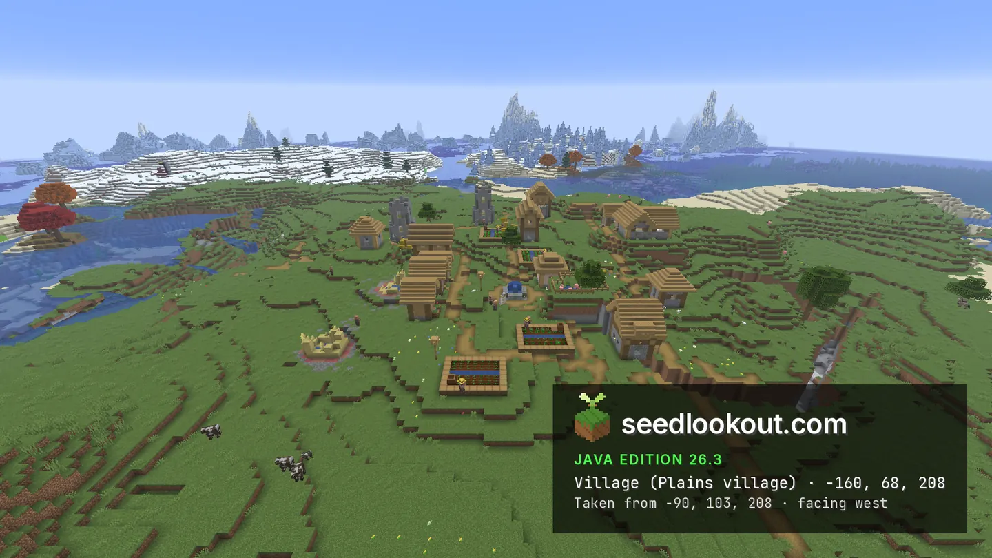
Plains village houses line a green coastal shelf beneath a tall rock pillar, with a wooden wreck by the shore and a monument visible offshore.
 Village
 Shipwreck
 Ocean monument
 Sulfur caves
 Coast
Coast Plains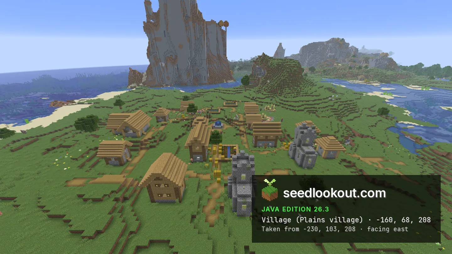
About this world
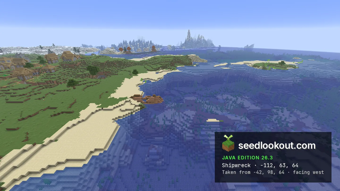
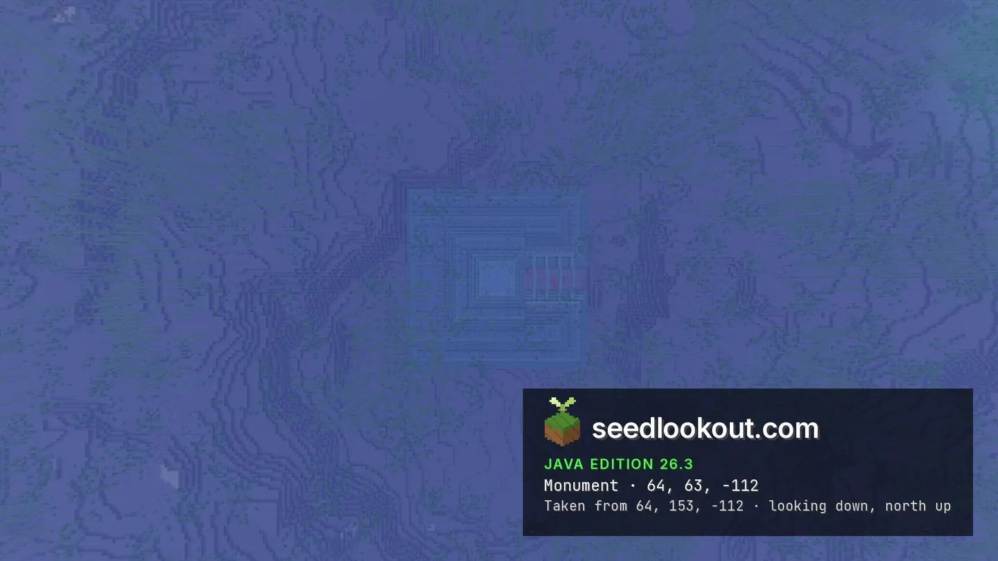
The plains village at -160, 68, 208 spreads across a grassy coastal shelf below a tall stone pillar. Its houses and paths follow the shore, with the blue ocean opening out beyond the buildings. A wooden shipwreck near -112, 63, 64 lies close enough to the shore for its hull to show in the photograph taken from the east, and the overhead monument view reveals a large patterned footprint beneath clear water.
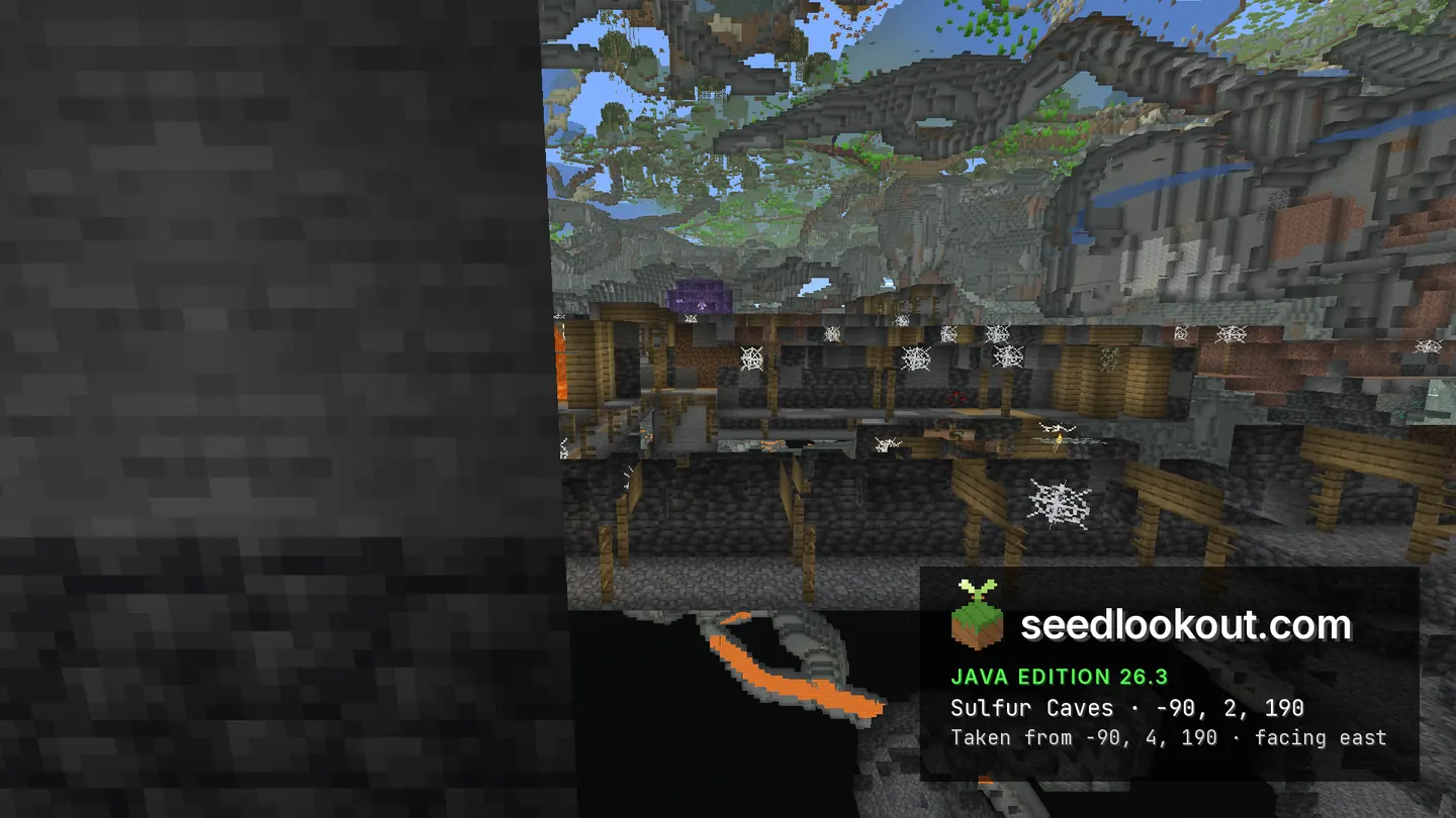
Sulfur caves were confirmed beneath -90, 190, with an underground inspection point at -90, 2, 190. The selected spectator cutaway mainly shows wooden mine supports and a purple crystal pocket through clipped terrain. The ocean monument is below the surface point at 64, 63, -112 and spans y 39–61.
Coordinates
Each structure and biome was found at or near these coordinates in Java 26.3.
| Location | X | Y | Z | Teleport |
|---|---|---|---|---|
| Coastal plains villageHouses and paths on a grassy shelf beside the ocean, below a tall stone pillar. The village structure spans y 61–81.Plains village found at these coordinates | -160 | 68 | 208 | |
| Sulfur cavesSulfur caves were confirmed at the underground inspection point -90, 2, 190. The selected cutaway mainly shows wooden supports and a purple crystal pocket through clipped terrain.Sulfur caves biome found at these coordinates | -90 | 2 | 190 | |
| Shoreline shipwreckA wooden hull visible beside the shore. This surface point anchors a generated wreck between y 58 and 66, around z 67–94.Shipwreck found 3 blocks away | -112 | 63 | 64 | |
| Ocean monumentA submerged monument with a patterned footprint visible in the overhead photo. The listed y 63 is the surface; its structure spans y 39–61.Ocean monument found at these coordinates | 64 | 63 | -112 |
Screenshots
Select a screenshot to open it at full size.
How to get there
- In Java Edition 26.3, choose Create New World, open the World tab and enter seed 5122454561084229.
- Set Game Mode to Creative or turn Allow Cheats on, and press F3 to show your coordinates.
- Run /tp @s -160 103 208 to view the village and coastal pillar. For the shoreline wreck, use /tp @s -112 98 64 and look towards z 67–94.
- Run /tp @s 64 98 -112 to look down at the ocean monument. Its structure is underwater between y 39 and 61, below the listed surface anchor.
- For the sulfur cave view, run /gamemode spectator, then /tp @s -90 2 190. This is a cutaway point inside the terrain, not a checked cave entrance.
Questions
What makes the village setting distinctive?
The reviewed views show village houses and paths on a green coastal shelf beneath a tall rock pillar, with open ocean beside the shore.
Can I see the wreck and monument in the gallery?
Yes. The wreck view taken from the east shows its wooden hull near the shore, and the monument overhead view shows the submerged structure's patterned footprint.
Is the sulfur cave screenshot a normal view from a path?
It is a spectator cutaway near the inspection point at -90, 2, 190, through solid terrain. Wooden supports and a purple crystal pocket are visible; a surface entrance was not checked.
Which Minecraft edition and version were checked?
This seed was checked in Java Edition 26.3. Other Java releases and Bedrock have not been checked.
Verified in game
Verified in game in Minecraft Java 26.3 on 2026-09-30. We checked the listed locations and reviewed the in-game screenshots before publication. Verification covers the listed structures and biomes in that version only, not the world spawn, chest loot or other versions. About verified seeds
Spawn and nearest structures
Predicted with the seed map’s Java 26.3 model and not checked in game. Distances are measured from the estimated spawn.
- Estimated spawn
- X 0, Z 144
- Surface height
- About Y 63
- Spawn biome
- Dappled Forest
Nearest structures
| Structure | X | Z | From spawn |
|---|---|---|---|
| Ruined portal | 64 | 208 | 91 blocks |
| Ocean ruin | 112 | 96 | 122 blocks |
| Shipwreck | -112 | 64 | 138 blocks |
| VillagePlains village | -160 | 208 | 172 blocks |
| Buried treasure | -39 | 361 | 220 blocks |
| Ocean monument | 64 | -112 | 264 blocks |
| Trial chambers | 336 | 320 | 379 blocks |
| Abandoned camp | 368 | 896 | 837 blocks |
| IglooBasement | -432 | 864 | 840 blocks |
| Witch hut | 368 | -864 | 1,073 blocks |
| Jungle temple | 736 | 1104 | 1,210 blocks |
| Trail ruins | -384 | -1264 | 1,459 blocks |
| Ancient city | -1520 | 1216 | 1,860 blocks |
| Pillager outpost | -1456 | 2208 | 2,526 blocks |
| Desert pyramid | 2112 | 3632 | 4,078 blocks |
No woodland mansion within 4,096 blocks of spawn.
Nearest strongholds
| Stronghold | X | Z | From spawn |
|---|---|---|---|
| Ring 1 | 1140 | 1460 | 1,741 blocks |
| Ring 1 | -2396 | 276 | 2,400 blocks |
| Ring 1 | 1060 | -2412 | 2,767 blocks |
Surface biomes within 1,024 blocks
- Swamp 15%
- Frozen Ocean 12%
- Deep Cold Ocean 10%
- Cold Ocean 8%
- Forest 8%
- Ocean 7%
Biome map
The seed map shows this world’s biomes and predicted structures with its Java 26.3 model. Its markers are predictions, like the spawn facts. Only the Coordinates table was checked in game.
Open the Java 26.3 seed mapMore seeds
Plains village on a sandy ocean peninsula, above sulfur caves
Village Trial chambersShipwreckSulfur cavesCoastPlains
3074086031640167
Plains village on rolling coastal hills above a river
VillageTrial chambers Ruined portalShipwreckPlainsCoast
 River
River150790707761055
Seaside desert village, with a desert ruined portal and Sulfur Caves near 0, 0
VillageRuined portalShipwreckSulfur cavesCoast871578676041918