seedlookout
JAVA 1.20.1 · VERIFIED IN GAME
Ocean village with wooden paths over the water
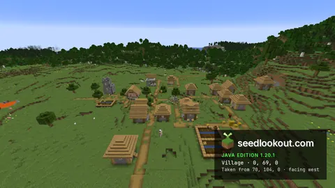
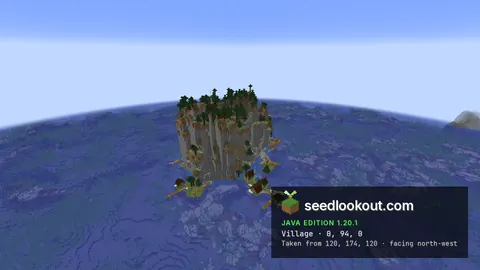
Village houses and farms occupy tiny green patches in the ocean, linked by long wooden paths that branch out over the water.
 Village
 Plains
 Island
 Ocean
Ocean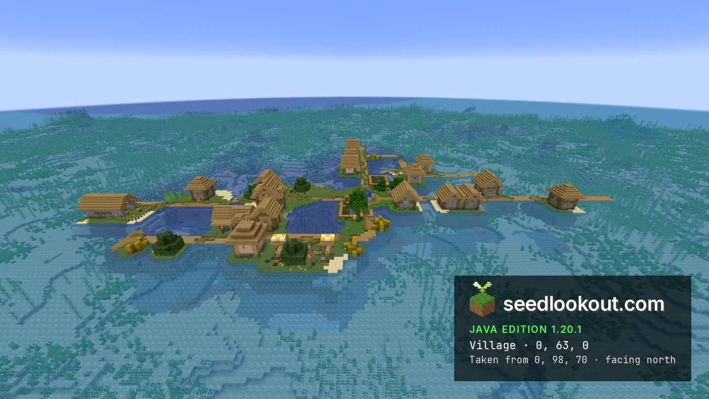
About this world
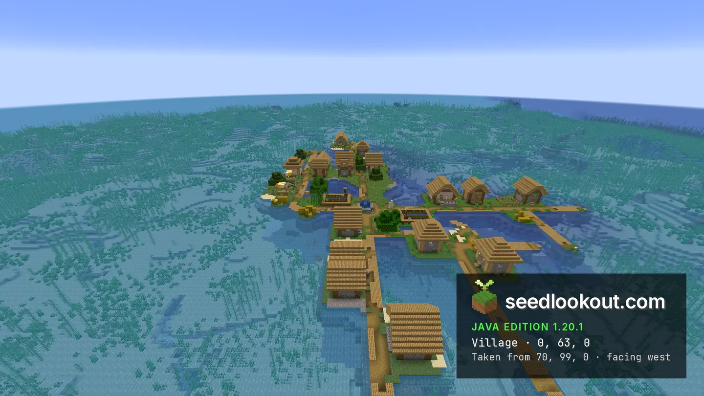
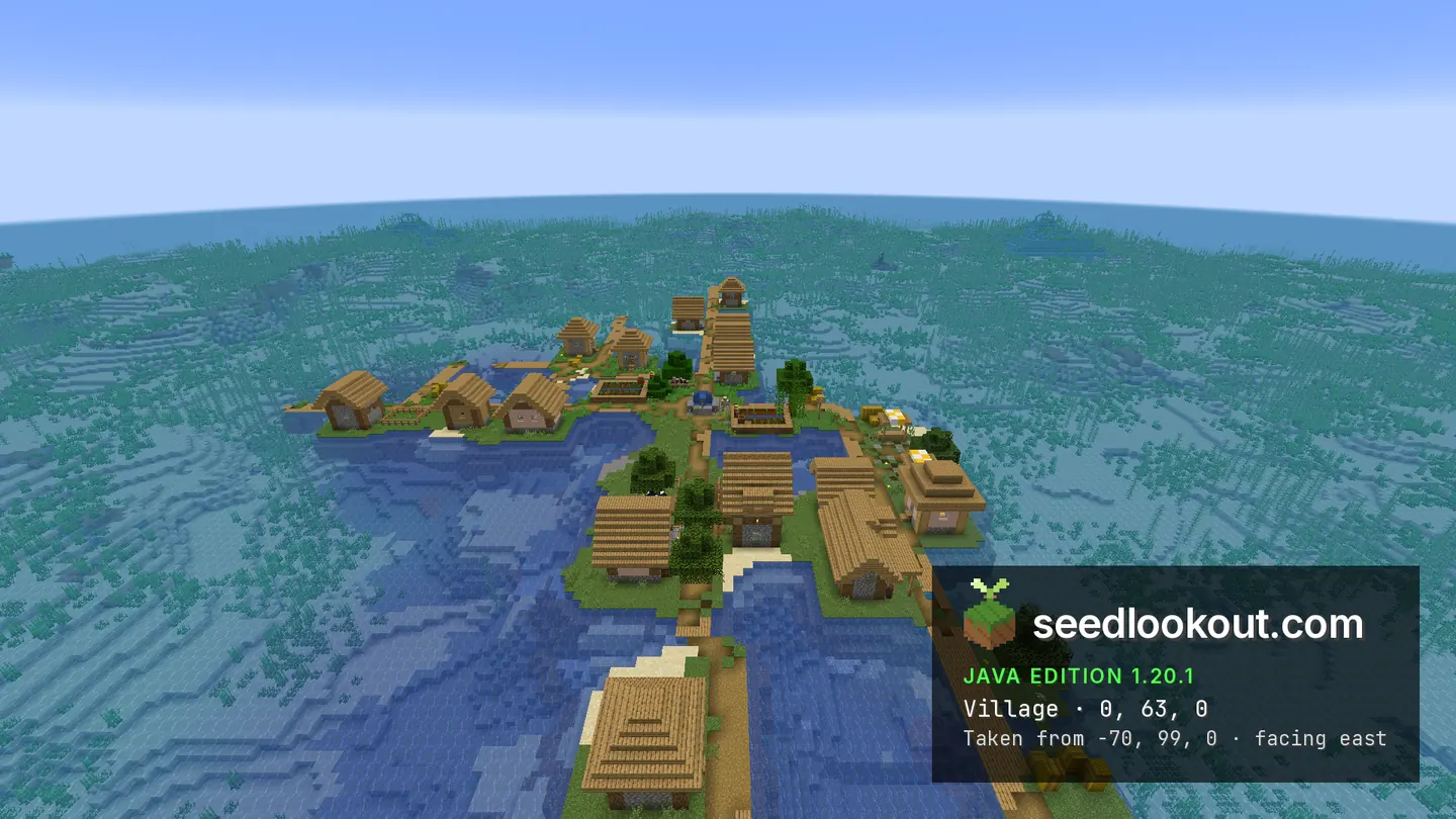
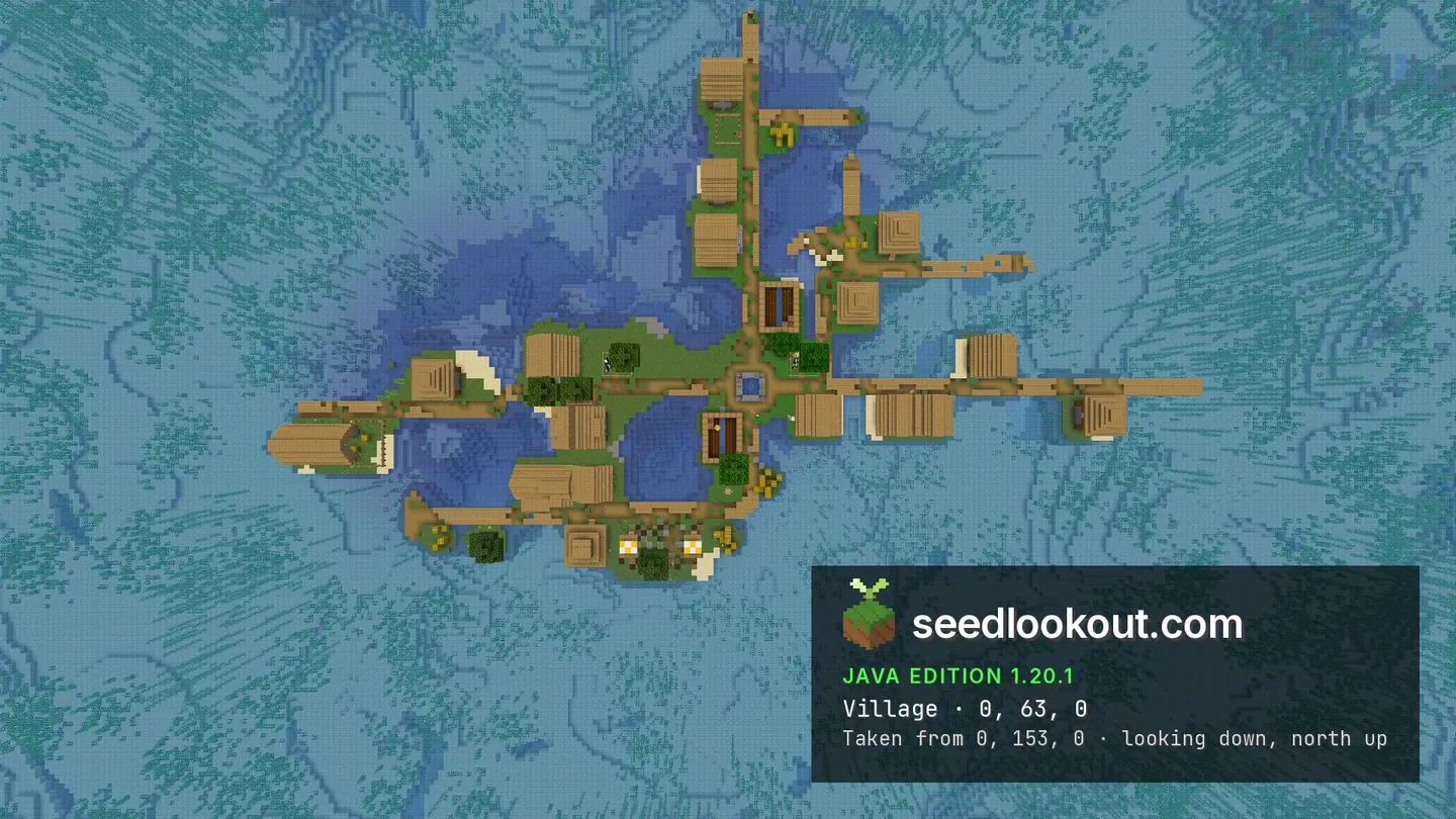
The village at 0, 63, 0 sits on a very small area of low green land surrounded by ocean. Oak roofs and farm plots rise above the water, while wooden paths connect the scattered buildings. Several paths extend well beyond the grassy patches, making the settlement look long and narrow from the east and west.
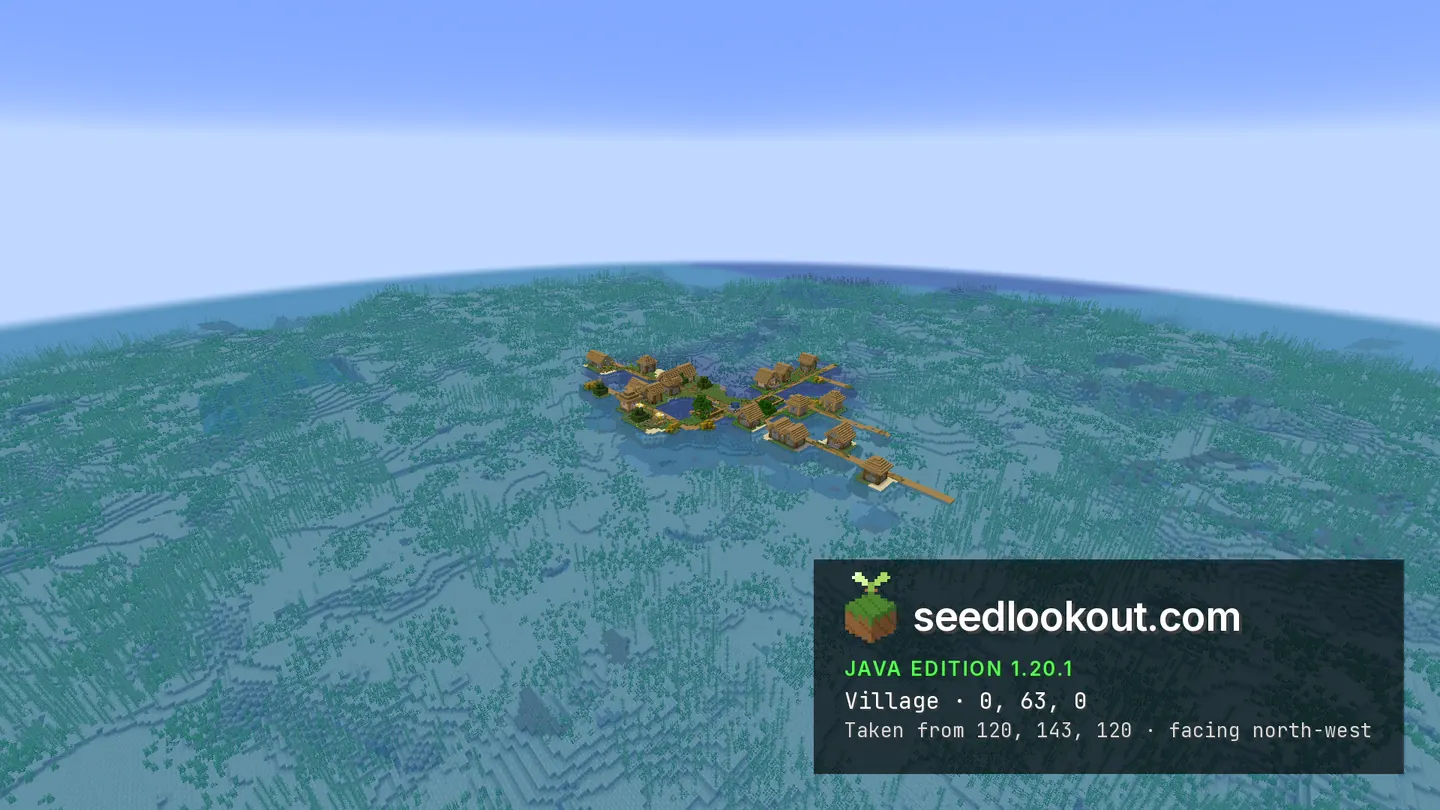
The overhead photograph shows wooden paths branching between the houses and crop plots, with stretches of open water between the green patches. Wider views place the compact settlement against the ocean and visible seabed. Looking along the paths from the east or west makes their length clearer than viewing the village straight down.
Coordinates
Each structure was found at or near these coordinates in Java 1.20.1.
| Location | X | Y | Z | Teleport |
|---|---|---|---|---|
| Ocean villageHomes and crop plots on low grassy patches surrounded by ocean, linked by branching wooden paths over the water.Plains village found at these coordinates | 0 | 63 | 0 |
Screenshots
Select a screenshot to open it at full size.
How to get there
- In Java Edition 1.20.1, choose Create New World, open the World tab and enter seed 131588442.
- Set Game Mode to Creative or turn Allow Cheats on, and press F3 to show your coordinates.
- Run /tp @s 0 110 0 to arrive above the village and see the wooden paths over the ocean. The checked point is near water level at y 63.
- Fly east or west of the settlement to look along the longer paths, then compare their branches with the overhead image.
- Descend towards the grassy plots in Creative before visiting the houses; several nearby paths extend above open water.
Questions
Where is the ocean village?
The checked point is 0, 63, 0 in Java 1.20.1. Small grassy plots hold the houses and farms, with ocean around them.
Do the paths really extend over water?
Yes. The screenshots show long wooden paths above the water connecting buildings and branching away from the small land patches.
Which view shows the path layout most clearly?
The overhead image shows the branches between the houses and farms. The east and west views look along the longer wooden stretches above the water.
Which Minecraft version was checked?
The world and screenshots were checked in Java 1.20.1. We have not verified the same terrain and structures in Bedrock or other Java versions.
Verified in game
Verified in game in Minecraft Java 1.20.1 on 2026-10-02. We checked the listed locations and reviewed the in-game screenshots before publication. Verification covers the listed structures in that version only, not the world spawn, chest loot or other versions. About verified seeds
Spawn and nearest structures
Predicted with the seed map’s Java 1.20.6 model and not checked in game. Distances are measured from the estimated spawn.
- Estimated spawn
- X -32, Z -32
- Surface height
- About Y 50
- Spawn biome
- Lukewarm Ocean
Nearest structures
| Structure | X | Z | From spawn |
|---|---|---|---|
| VillagePlains village | 0 | 0 | 45 blocks |
| Ocean ruin | 128 | 0 | 163 blocks |
| Ocean monument | -192 | 112 | 215 blocks |
| Shipwreck | 192 | 64 | 244 blocks |
| Ruined portal | 288 | 224 | 410 blocks |
| Trail ruins | 1632 | 144 | 1,673 blocks |
| Ancient city | 1632 | -224 | 1,675 blocks |
| Pillager outpost | 1072 | -1888 | 2,160 blocks |
| Igloo | 3216 | -272 | 3,257 blocks |
| Woodland mansion | 2864 | 2688 | 3,973 blocks |
| Jungle temple | -2048 | 3440 | 4,015 blocks |
No desert pyramid or witch hut within 4,096 blocks of spawn. No buried treasure within 1,024 blocks of spawn.
Nearest strongholds
| Stronghold | X | Z | From spawn |
|---|---|---|---|
| Ring 1 | -1772 | -220 | 1,750 blocks |
| Ring 1 | 1188 | -1500 | 1,909 blocks |
| Ring 1 | 964 | 2148 | 2,397 blocks |
Surface biomes within 1,024 blocks
- Lukewarm Ocean 31%
- Deep Lukewarm Ocean 27%
- Deep Ocean 18%
- Ocean 14%
- Plains 4%
Biome map
 Shipwreck
 Taiga
Taiga